How St. Louis Is Becoming America’s Geospatial Capital
- May 26, 2026
Key Takeaways
- GeoSTL was launched in 2026 to advance the St. Louis geospatial ecosystem.
- St. Louis is executing a long-term strategy to lead in geospatial technology, guided by the GeoFutures Strategic Roadmap.
- Investments in talent and startups are positioning Missouri for long-term growth across industries that rely on location intelligence.
St. Louis is carving out a distinct leadership position in one of the fastest-growing sectors of the global economy: geospatial technology. Through coordinated efforts like GeoSTL and the GeoFutures initiative, the region is not just participating in this growth; it is actively shaping what comes next.

GeoSTL: A Unified Vision for Geospatial Leadership
GeoSTL represents a collaborative push to elevate St. Louis as a premier geospatial hub. Anchored by a unique concentration of federal agencies, research institutions, and private-sector innovators, the initiative serves as a backbone, connecting the globally recognized geospatial ecosystem spanning federal agencies, leading research institutions, private industry, startups, and a growing talent pipeline.
As GeoSTL notes, “Together, these assets position the region as a center of innovation, national security, and economic opportunity—and GeoSTL exists to connect, grow, and champion all of it.”
With the National Geospatial-Intelligence Agency’s western headquarters and a strong ecosystem of universities and research centers, St. Louis has the foundational assets needed to lead. GeoSTL aligns these strengths under a shared vision, fostering collaboration, accelerating innovation, and establishing St. Louis as a global destination for geospatial excellence.”
GeoFutures: A 10-Year Roadmap for Growth
GeoSTL will guide the execution of GeoFutures, translating strategy into action through a focused, 10-year roadmap for growth. This roadmap outlines how St. Louis can strengthen its position as the nation’s geospatial center of excellence by focusing on areas where it holds a distinct competitive advantage.
To bring this vision to life, the GeoFutures roadmap outlines five strategic priorities that will guide the region’s efforts over the next decade:
- Scale talent and workforce development to meet growing industry demand
- Raise innovation capacity for advanced applications across key industries
- Accelerate entrepreneurship and access to risk capital
- Support community-driven development, especially north of Downtown near NGA West
- Strengthen the region’s brand as a national geospatial thought leader
Together, these priorities reflect a comprehensive approach, one that connects people, innovation, capital, and community to drive long-term success.
St. Louis is strengthening its position as a national leader in geospatial innovation. Through the newly defined backbone, GeoSTL, and its strategic roadmap, GeoFutures, the region is aligning research, talent, and industry to drive real-world impact. From advancing national security to transforming agriculture and supply chains, the future of geospatial is being built here in Missouri.
Learn more about Missouri’s growing geospatial industry and ecosystem.
Related News

How St. Louis Is Becoming America’s Geospatial Capital
Key Takeaways St. Louis is carving out a distinct leadership position in one of the fastest-gro ... Read More
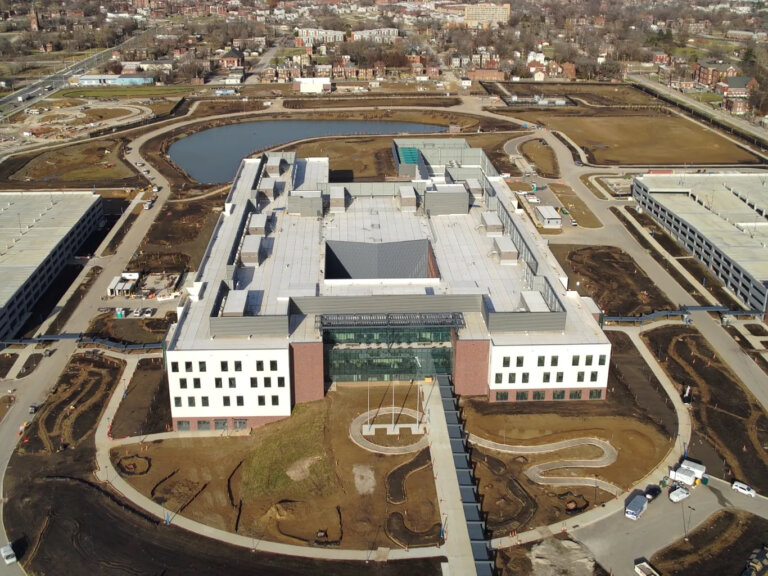
NGA’s New $1.7 Billion Campus Opens in St. Louis
Next NGA West, the National Geospatial-Intelligence Agency’s new $1.7 billion western regiona ... Read More

Missouri’s Diverse Economy Strengthens Growing Agtech and Geospatial Industries
Missouri’s deep roots in agriculture and aviation are the foundation of its thriving industri ... Read More